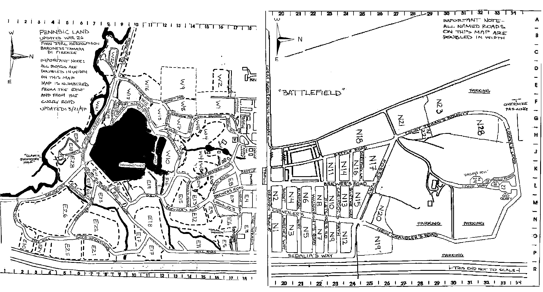
This is a modified version of the map found at the
Barony of An Dubhaigeainn's Pennsic web page. I scaled
the two maps to be *almost* the same scale (I'll try again
when I'm feeling more patient) and did a little cleanup of
stray marks, told PhotoShop to sharpen the image, and reduced
it to as few shades of grey as I could convince PhotoShop to
do ... the end result is a version that's all in one file,
has been shrunk to 77K, and is, unfortunately, slightly less
legible (but mostly useable). It'll fit on an 8.5"x11" page
in landscape mode if you shrink it to 41%. Having printed it
out for my own uses, I figured I'd put it back up on the web
in case anyone else finds it useful.
Note that at least one better (and more current) map is
available elsewhere on the web. When I remember where I
stuck that bookmark, I'll put a link to it here.
 Not sure what the copyright status of this is -- I didn't draw it or scan it but I modified the image -- 1997, D. Glenn Arthur Jr.
![[What's new at this site]](http://www.kempt.net/~glenn/bang1.gif) Last updated 2001-11-06.
Last updated 2001-11-06.